


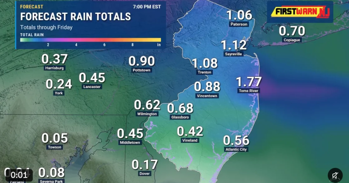
NEW JERSEY — Gov. Mikie Sherrill is urging residents to prepare for heavy showers, gusty winds, and possible minor coastal flooding as a developing storm system moves across New Jersey Thursday, November 12, and into Friday.
In a statement posted on X, Sherrill warned that unsettled weather would continue through Friday evening, followed by much colder temperatures over the weekend. She urged residents to monitor local forecasts and avoid driving through flooded roads.
The National Weather Service expects a strengthening low-pressure system to move toward the New Jersey coast, bringing periods of moderate to heavy rain. Thunderstorms are also possible in some areas Thursday afternoon and evening.
Coastal communities face an additional concern as onshore winds push water toward low-lying areas. A Coastal Flood Advisory has been issued for Ocean County, with minor tidal flooding possible around Barnegat Bay. Some roads near the waterfront could become temporarily impassable.
Colder Temperatures Expected This Weekend
After the rain moves through, New Jersey will experience a sharp drop in temperatures.
Friday’s highs are expected to remain in the 40s across much of the state, with overnight temperatures falling into the 20s and low 30s in some areas.
Saturday is expected to be especially windy, with gusts approaching 30 mph in parts of the region. Temperatures will remain below seasonal averages through the weekend.
Residents are encouraged to secure loose outdoor items, use caution on wet roads, and follow updates from the National Weather Service and local emergency officials.
Sources: Governor Mikie Sherrill, official X statement, November 12, 2026; National Weather Service, Mount Holly, November 12, 2026.
By NJ RADAR Team