


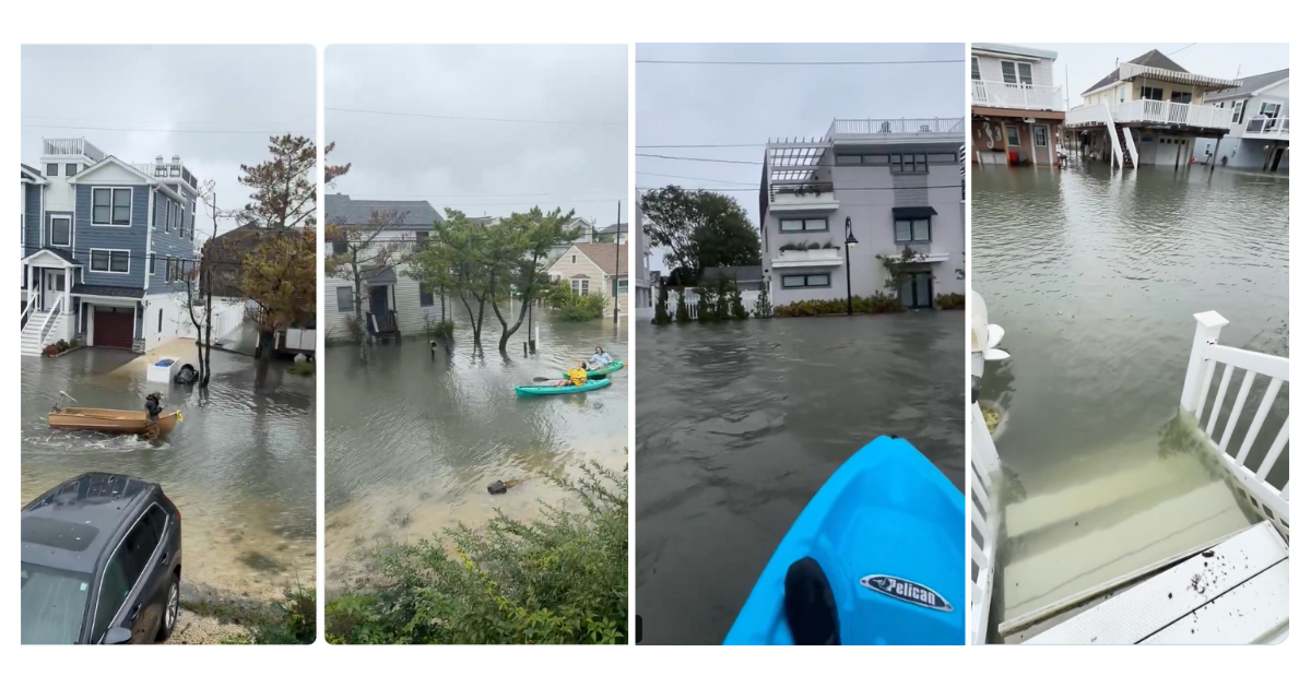
A powerful nor’easter is already causing serious coastal flooding across parts of New Jersey, with several Shore communities reporting roads underwater, dangerous high tides and rapidly worsening conditions.
In Manasquan, East Main Street and surrounding areas were reported virtually impassable Saturday morning because of major tidal flooding. The National Weather Service has warned that parts of Monmouth County could see two to three feet of inundation above ground level in low-lying areas near shorelines and tidal waterways.
Manasquan Among the Hardest-Hit Areas
Manasquan is one of the communities seeing some of the most visible flooding this morning, with water covering roads and pushing into low-lying neighborhoods near tidal waterways.
The National Weather Service had forecast major coastal flooding around the morning high-tide cycle, with the most severe impacts expected in vulnerable back-bay and riverfront areas. Roads can become impassable at these levels, and some locations may become temporarily isolated.
News 12 has been documenting rapidly deteriorating conditions along the Jersey Shore, including flooded streets, storm surge in Bay Head, flooding in Surf City and powerful surf striking the coastline.
Flooding Spreads Across the Shore
The threat extends well beyond Manasquan.
Coastal Flood Warnings remain in effect for eastern and western Monmouth County, Middlesex County, Cumberland, Atlantic and Cape May counties, with the National Weather Service warning of widespread roadway flooding and possible structural damage in the most exposed communities.
In eastern Monmouth County, the storm is also producing waves of up to 12 feet, along with dangerous rip currents and significant beach erosion.
News 12 reported flooding Saturday morning in Surf City even around low tide, while storm surge was already affecting Bay Head and other coastal areas.
More High Tides Still to Come
The danger is not limited to one tide cycle.
Coastal Flood Warnings remain in effect into Sunday afternoon for several parts of the state, meaning additional high tides could push more water into roads, neighborhoods and back-bay communities. The National Weather Service says some areas could experience repeated moderate or major flooding before conditions begin to improve.
Strong winds are adding to the risk. The storm is also bringing heavy rain, high surf and possible power outages, while forecasters warn that beach erosion could become substantial along parts of the Jersey Shore.
Farther south, video from Wildwood in Cape May County also showed streets flooded as the nor’easter moved toward the Jersey Shore.
Major flooding was also reported in Sea Isle City, where streets were inundated as the nor’easter pushed water into low-lying coastal areas.
Drivers Urged to Avoid Flooded Roads
Officials are urging residents not to attempt to drive through flooded streets, especially in coastal and bayside areas where water levels can rise quickly around high tide.
With more rounds of dangerous tides expected through the weekend, residents in low-lying communities are being advised to keep monitoring local warnings and road conditions.
For now, the clearest images of the storm are already coming from the Shore: submerged roads, water pushing into neighborhoods and waves pounding the coastline as the nor’easter continues moving through New Jersey.
Sources: National Weather Service; News 12 New Jersey; PBS NewsHour.
By NJ RADAR Team
[…] Earlier Saturday, some of the most dramatic flooding was concentrated along the Jersey Shore, including Surf City, Manasquan, Wildwood and Sea Isle City. […]